Tag Archives: Rockies

Dear Jake: the story of two mountains

July 15th, 2012


Dear Jake:


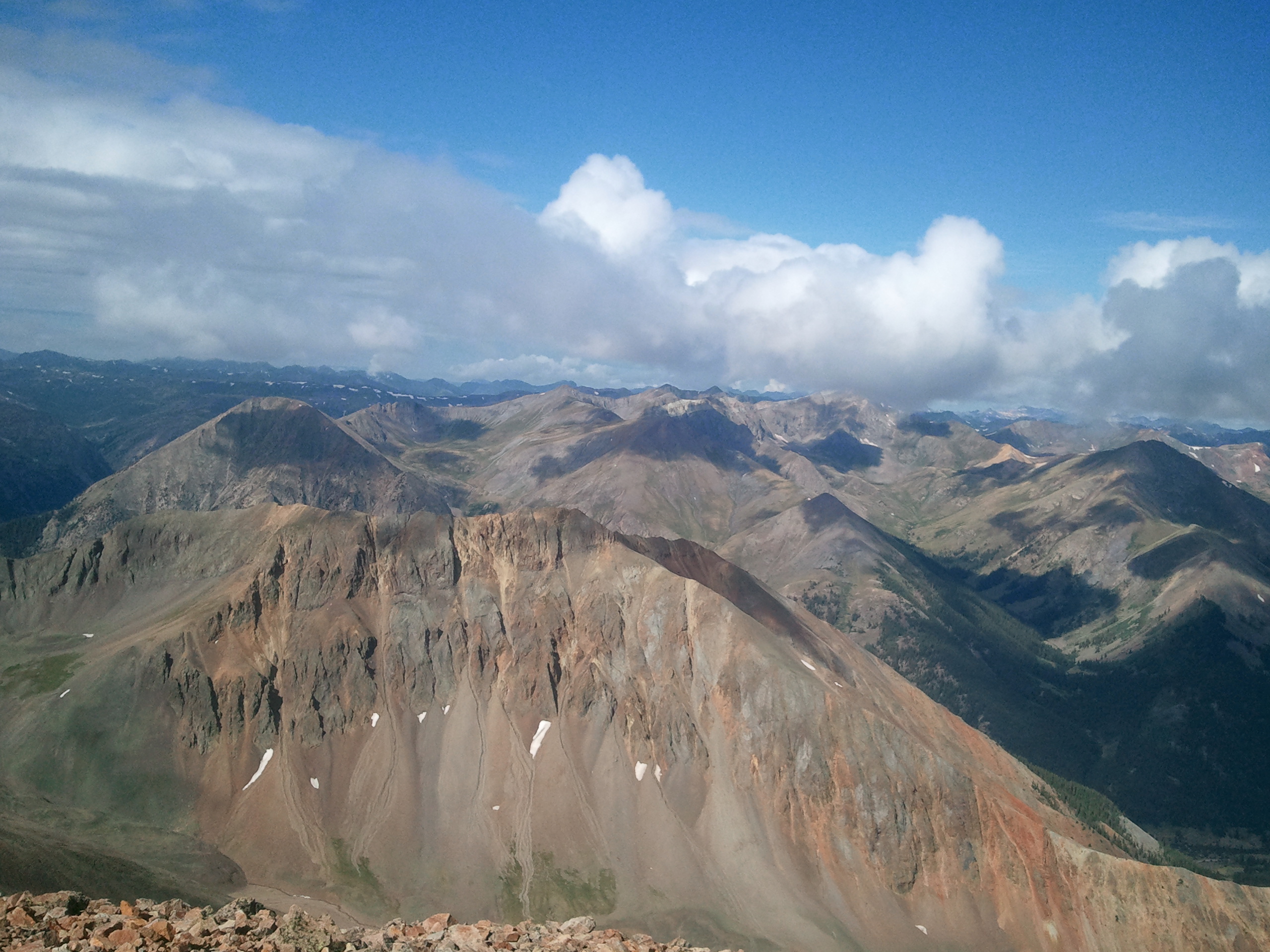
I was hiking Redcloud (14,034′) and Sunshine (14,001″) Peaks near Lake City, Colorado and thinking about how you have made me more cautious in my personal outdoor pursuits. Cautious for good measure, but before your accident, I would not have given much of what I do on my own time, in the mountains, by myself a second thought.

SAMSUNG

I never really planned anything too thoroughly (still don’t) and never told anyone where I was going – mostly because I would go somewhere with a plan in mind, get there and change it. I would just get in my car, drive to an area I thought was cool and strike out. When I lived in Utah, I would often combine this with an overnight out there, which I never really knew where it would be until I got there.

SAMSUNG

I felt like, if I told someone where I was going, I would have to commit to that plan and not change it once I got there. You know, I like to kind of float around and see what my options are in an area before committing to a hike.


I spent part of my summer vacation in Colorado and did a few hikes – including the two above mentioned Fourteeners and another Fourteener, Mt Bierstadt, near Georgetown.


Mt. Bierstadt I did on your birthday – with the motto of “WWJD? – What Would Jake Do?” floating around in my head – as I really just happened to be driving by, had a nice window on the weather and could see the trail was a short one.


I even told people where I was going! Especially because I was hiking these mountains by myself. I did wait until I was partway up Bierstadt before letting people know where I was, but still . . . Not something I ever thought about or did previously.


I looked up the Redcloud and Sunshine routes a day previously, in the Alamosa, Colorado Welcome Center. When I told the man running the desk what my plan was, he asked if I was going by myself and if I thought that was safe. I told him I figure there are other people out there and that I typically tell people what I am up to. I almost mentioned your accident to him, but decided it was best not to.

SAMSUNG

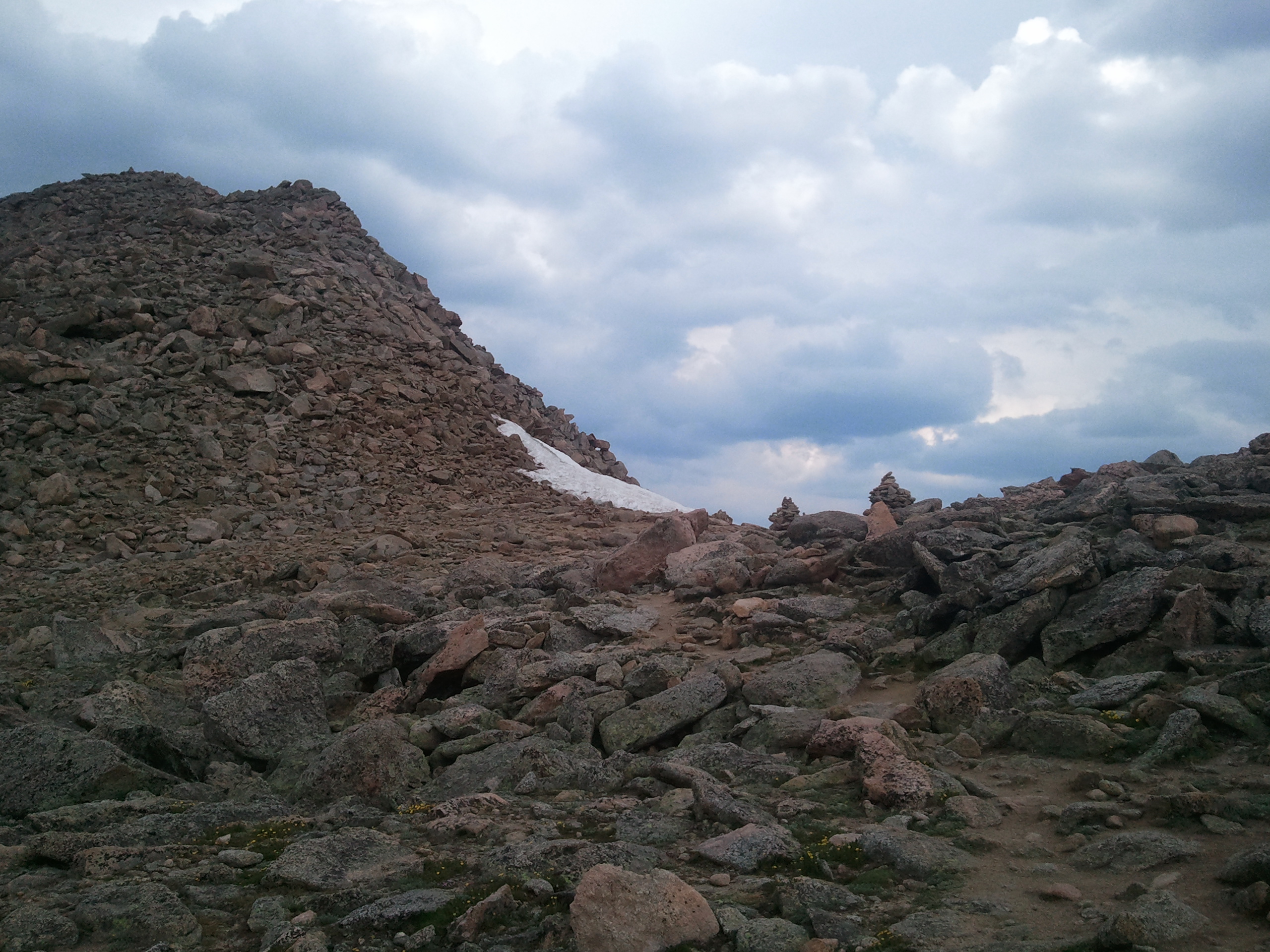
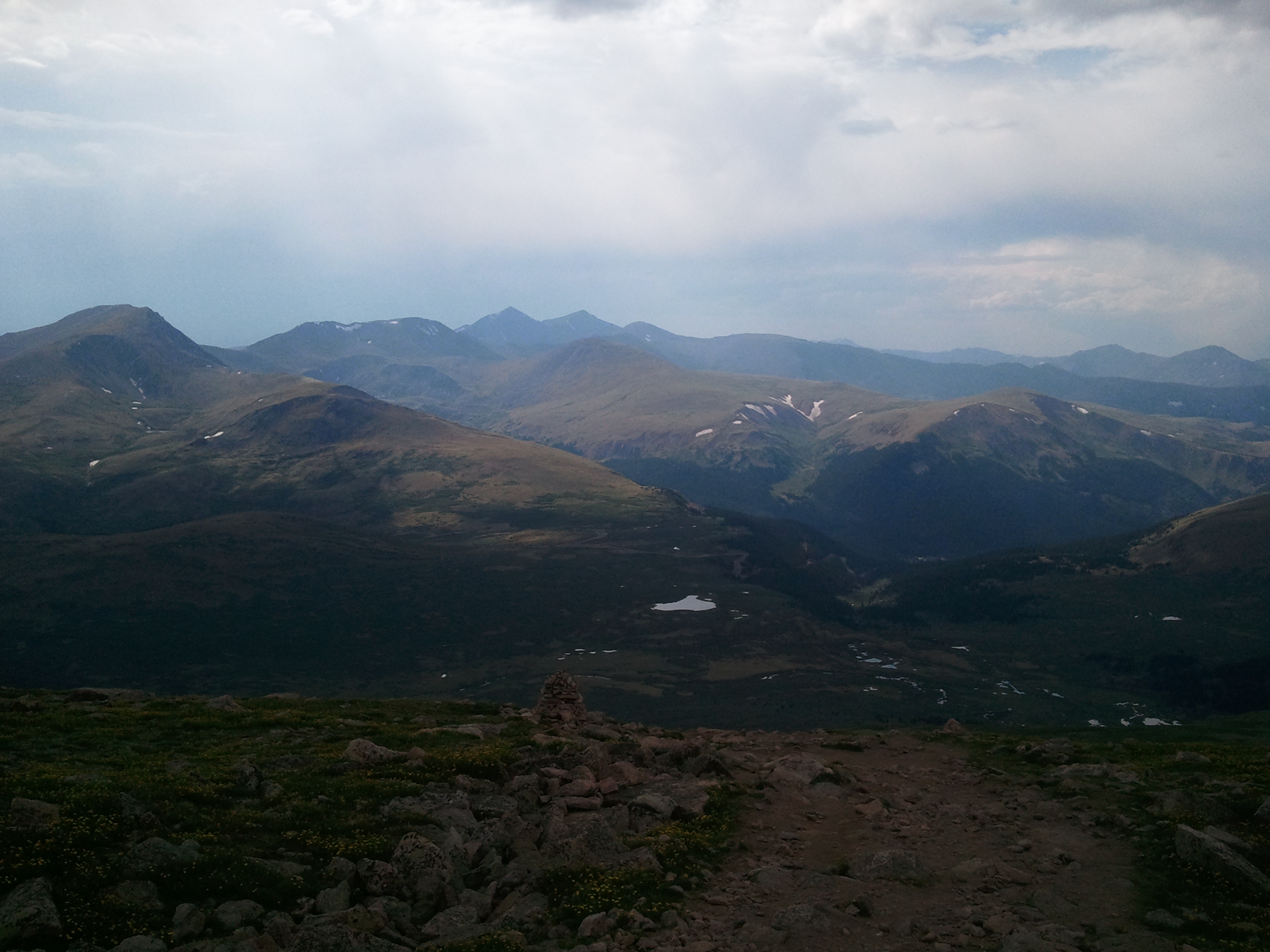
Anyway, I was hiking along up there on Redcloud, headed towards Sunshine, which involves a mile-long ridge walk that drops several hundred feet before climbing back up to Sunshine. In the bottom of the saddle, there was a sign that read: “Dangerous Area, Not a Trail, Return via Redcloud.” I looked down and all I could see was a massive scree field down into a valley, which would go, eventually, back to the trailhead.

SAMSUNG

In my younger days, I probably would have walked right around that sign and slid down the field to hasten my descent. I might also have walked the opposite way off of Sunshine and down the ridge – which I had scoped out from the parking lot – that led straight to the parking lot. A knife-edge ridge, which probably has all sorts of cliff bands along both sides. I could see several slide paths out there as well. When I talked with a couple of other hikers at the top, they mentioned there was another person ahead of them, who, they said: “went that way (towards the knife-edge and parking lot).”


I told them it was tempting, but not by myself. I turned around and hiked back the way I came, the long ridge to the top of Redcloud. On my way back, I ran across two hikers I had seen leaving the parking lot minutes behind me. Apparently, they came up the “dangerous area” and the woman seemed kind of upset that they had done that. I told them I came over the trail and noted to myself that they were about an hour behind me.


On top of Redcloud (my second time for the morning) I talked with two other solo hikers. Both mentioned the route out through the danger area, but told me they were coming back. I said I had thought about it if I needed to escape lightning, but I was not going to go that way by myself when only a few people knew where I was to begin with.

SAMSUNG

This new caution is thanks to you, Jake. It is something that I try to practice and maintain now. I am sure my friends who were back in Denver or Buena Vista at work were annoyed that I kept texting them to tell them what mountain or trail I was hiking the next day, but at least someone knew where I was. And they knew, if I didn’t check back in with them something might have happened.


I want to keep hiking the mountains and canyons as long as I can. As long as my knees will carry me in and out, as long as my mind and lungs can handle the work. And now, I want to hike them in the safe manner. Maybe I won’t have every piece of equipment, or the right clothes, or even the right shoes, but I am still going to hike out there. I am going to take the safe, recommended route and wait for others to join me on the hard stuff.  And, someone will hopefully always know where I am and what I am doing.


Yours in the mountains, Adam

Leave a comment

Filed under Outdoors

Mt. Bierstadt: Ode to Jake

I had been debating about driving Guanella Pass for my transit from Estes Park to Salida, Colorado on the 2nd of July. It would not be that far out of the way and might be kind of scenic. The friend I had been visiting in Estes Park mentioned that Mount Bierstadt (14,056′) was along that route, which kind of stuck in my brain for a bit.


I figured leaving Estes in the morning, going over Trail Ridge Road and down to Georgetown would not leave me with much of an opportunity to hike Bierstadt. I would be driving by in the afternoon, when it would likely be out of the question.


I started my morning on the 2nd with a quick run around the maintenance area at Rocky Mountain National Park, crashing the ROMO Trails morning meeting. I went to town, grabbed a bagel for breakfast and headed over the top. I had planned on hiking somewhere on the west side of the park, but knew not where. I finally found a map and determined a short four-mile round trip to Big Meadow seemed worth it.


I found the trailhead and started up, taking pictures of the flowers by the creek and thinking about Jake Rigby, as the 2nd would have been his 28th birthday. I thought a hike on his birthday would be a great way to commemorate him.


The trail went straight up a drainage and then dumped out into the Big Meadow, which as the name implies is a big alpine meadow. I sat on a rock and reflected for a few moments before traipsing back down the trail.


My driving journey continued south into Winter Park, over Berthoud Pass in the rain and down into Georgetown. Having woken up early, I found the Georgetown Visitor’s Center and took a nap, while it was raining, in my car in the parking lot. I had plenty of time to kill before heading over Guanella Pass into Salida and since it was still lightly raining, I walked around town for a bit. There was still the thought of Bierstadt in the back of my mind, but it was raining in Georgetown, several thousand feet lower, so the weather up there must have been bad as well.


Eventually, I made my way up Guanella and stopped at the Guanella Summit, which was also the parking lot and trailhead for Bierstadt. As I was taking a few pictures of the mountain, a group walked in from the top and I could see a few other people trickling back along the trail. The trail was clearly visible all the way from the parking lot to the top, and thanks to a flyer that I had glanced at in town, I knew the trail to be only three and a half miles.

SAMSUNG

I was still wearing my tennis shoes from my run that morning and I decided, well, why not, maybe I will just walk out along the trail for a bit and take a few pictures, no plan to go to the top really, but maybe. I threw on a long-sleeved shirt, lathered up with sunscreen, grabbed my camelbak and started along the trail. No food, no plan, no map, no rain gear and nobody really knew I was there. I could see to the west a few clouds, but nothing really threatening looking.

SAMSUNG

The first mile or so of the trail goes through a wet meadow, with a lot of boardwalks. As I casually walked across this, I picked a point out on the trail – a long ridge that I could see the trail switchback to the top of and thought: “well, I will just go that far.”


Once on the switchback, I could see the clouds still being non-threatening and the top was not really that far away. The trail is only three and a half miles and I had probably already covered at least a mile and a half. How much longer would it take to climb another two miles or so on a decently maintained trail?


I had been hiking for about an hour and as I took out my phone to take a few pictures, I noticed that I had service. Something had been sticking in my craw (probably the fact that no one knew where I was and people would be waiting on me in Salida) about me not telling anyone where I was. So, I texted three people, who live in Colorado, from the side of the mountain to let them know what I was up to. I got a text back that said: “great hike! have fun!” So – at least one person knew what I was doing.

SAMSUNG

The trail dumped me out at the bottom of a scree field that still had a faint marking of a trail, along with a few scattered rock cairns. This is where I really started thinking about and talking to Jake. Thinking of the whole “WWJD?” — “what would Jake do?” thing we came up with not long after he left us. I knew that this is exactly what he would be doing – a late afternoon, unplanned wander up the side of a Fourteener with limited gear, because he was there and he had the daylight and time.


I began talking with him, but mostly cussing him as I climbed up through this crazy rock scree . . . “Jake, you crazy SOB – I can’t believe you are making me do this on your birthday! You are f-ing insane!”

SAMSUNG

As I was talking with him, thinking about him and what it would have been like had he made it to 28 . . . I felt a kind of tingling sensation come over me. Not chills or anything, but a definite power of something unexplainable that washed over me and pushed me onwards. For most of the scree slope and the final summit pitch I could feel this.


I kept thinking that Jake, along with my departed mother, were probably watching me, perhaps even together, and pushing me towards the top.


As I got ready to climb the final summit pitch, I noticed two other persons ahead of me. I caught up to them on the top and we exchanged pleasantries, while they took my photo. We also saw that a storm was coming towards us.

SAMSUNG

They left as I entered my name into the peak register. I took a few pictures and scrambled to the bottom. Telling Jake that I wished I could take longer to reflect upon him and this mountain I climbed for his birthday, but I needed to get down before the storm came. I did thank him for the great views provided.

SAMSUNG

I slowly picked my way through the scree field back to the maintained trail. Once there I picked my way out of the rockier sections and began to run down the trail. Less that a storm was coming, but more that I wanted to get to the bottom quickly. Plus, I thought it would be a fun thing to do, to test out my running skills at 13,000 feet. I knew that is something that Jake would have done. I ran past a few other hikers, fielded one phone call from my friend who knew I was up there (right before I lost service) and did not have to duck for any lightning (though I did hear thunder a couple of times).

SAMSUNG

SAMSUNG

Once reaching my friend’s house in Salida, I was rewarded with a shower, drinks and three hamburgers. Thanks to all, especially those who watched over my climb.

Leave a comment

Filed under Outdoors